This website is the second phase of an ongoing project to create a comprehensive record of movable
bridges in the British Isles. (For a definition of the term 'movable bridge' and a glossary
click
here.)
The project was born about 2003 when I became aware that at least two large swing bridges on the Norfolk Broads
had been demolished, and that other movable bridges were falling into disuse. Out of idle curiosity I
looked for information on the history of the bridges concerned but could not find any significant
record. I quickly realised that there was little evidence of any attempt to record the use of such
structures in our transport network, apart from a few isolated studies for areas such as the Manchester
Ship Canal or Bridgwater Docks and the Bridgwater and Taunton Canal. Even the Highways Agency does not
keep a central record of movable bridges on major highways.
It seemed to me that these structures formed a part of our industrial heritage and took a decision
to locate all existing examples. This initial research was the first phase of an idea that has grown
and grown! I expected to find about 150 - 200 movable bridges in the British Isles. My intention
was to travel the country, photograph them all, research their history, and then to publish a complete
work. It quickly became clear that I had seriously under-estimated how many movable bridges there were
and are. I have also been pleasantly surprised by the number of new ones being built, and excited by the
innovative design of many of these new ones. There has also been a concerted effort in some areas to
preserve or restore bridges that had fallen into disuse or were threatened with destruction.
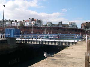
The Royal Harbour, Ramsgate
As the number of possible examples approached 750 I realised that to photograph every single one
myself and to research the histories would take many years. I took the decision to 'go public' with
the information I had gathered so far, in the hope that other interested groups and individuals would
then contribute information for Phases 3 and 4.
By October 2009 I had over 2650 bridge locations in my database, including several hundred references to drawbridges
associated with castles, forts and other defensive structures. I have been researching this grouping intensively
during 2009 and will be adding these to the website during the winter of 2009-10.
Before launching the website I had already received significant help and support from several individuals,
groups and organizations. Since the launch I have received even more help from visitors to the site which
is enabling me to build-up a truly comprehensive historical record of movable bridges in the British Isles.
My own research will continue. Phase 3 was always the photography, and I will continue to photograph
structures or sites as I travel around the country. Phase 4 is to build up the historical background
of each bridge. This will involve accessing archival material - when I find it - and is likely to take
some years on a part-time basis. Phase 5 involves researching the lives of individual bridge builders
and the histories of companies involved in bridge buidling. This work will continue in parallel with phases 3 and 4.
While I make extensive use of the internet for research and communication I had realised that I did not
have the technical knowledge and ability to create the high quality and complex website that the project
demanded. I was greatly relieved therefore to discover that John Hazell did have that expertise, and I am
indebted to John for his offer of support, his determination to solve all the complex problems of structure
and process that my ideas for the website demanded, and his time and patience in creating it.
Stewart Marchant